- Article
(7847 KB) - Metadata XML
- October 16, 2026
- |
- Home
- |
- Sitemap
- |
- The ISPRS Foundation
- |
- 𝕏
The International Archives of the Photogrammetry, Remote Sensing and Spatial Information Sciences





Articles | Volume XLIX-B1-2026
https://doi.org/10.5194/isprs-archives-XLIX-B1-2026-255-2026
© Author(s) 2026. This work is distributed under
the Creative Commons Attribution 4.0 License.
the Creative Commons Attribution 4.0 License.
https://doi.org/10.5194/isprs-archives-XLIX-B1-2026-255-2026
© Author(s) 2026. This work is distributed under
the Creative Commons Attribution 4.0 License.
the Creative Commons Attribution 4.0 License.

22 Jul 2026
| 22 Jul 2026
Geometric and radiometric Calibration of a rotating multi-beam Lidar using a rotating tilted Platform
Heikki Hyyti
Finnish Geospatial Research Institute FGI, National Land Survey of Finland, Vuorimiehentie 5, Espoo, Finland
Matias Mäki-Leppilampi
Finnish Geospatial Research Institute FGI, National Land Survey of Finland, Vuorimiehentie 5, Espoo, Finland
Harri Kaartinen
Finnish Geospatial Research Institute FGI, National Land Survey of Finland, Vuorimiehentie 5, Espoo, Finland
Related authors
Evgeny Lopatin, Kari Väätäinen, Harri Kaartinen, Heikki Hyyti, Lauri Sikanen, Yrjö Nuutinen, and Mauricio Acuna
ISPRS Ann. Photogramm. Remote Sens. Spatial Inf. Sci., X-2-W2-2025, 117–123, https://doi.org/10.5194/isprs-annals-X-2-W2-2025-117-2025, https://doi.org/10.5194/isprs-annals-X-2-W2-2025-117-2025, 2025
Matias Mäki-Leppilampi, Heikki Hyyti, and Harri Kaartinen
ISPRS Ann. Photogramm. Remote Sens. Spatial Inf. Sci., X-2-W2-2025, 125–132, https://doi.org/10.5194/isprs-annals-X-2-W2-2025-125-2025, https://doi.org/10.5194/isprs-annals-X-2-W2-2025-125-2025, 2025
Eugeniu Vezeteu, Heikki Hyyti, Ville Kyrki, and Juha Hyyppä
ISPRS Ann. Photogramm. Remote Sens. Spatial Inf. Sci., X-2-W2-2025, 199–206, https://doi.org/10.5194/isprs-annals-X-2-W2-2025-199-2025, https://doi.org/10.5194/isprs-annals-X-2-W2-2025-199-2025, 2025
Zuoya Liu, Harri Kaartinen, Teemu Hakala, Heikki Hyyti, Antero Kukko, Juha Hyyppa, and Ruizhi Chen
ISPRS Ann. Photogramm. Remote Sens. Spatial Inf. Sci., X-G-2025, 551–557, https://doi.org/10.5194/isprs-annals-X-G-2025-551-2025, https://doi.org/10.5194/isprs-annals-X-G-2025-551-2025, 2025
Tamás Faitli, Heikki Hyyti, Juha Hyyppä, Antero Kukko, and Harri Kaartinen
Int. Arch. Photogramm. Remote Sens. Spatial Inf. Sci., XLVIII-1-W4-2025, 37–42, https://doi.org/10.5194/isprs-archives-XLVIII-1-W4-2025-37-2025, https://doi.org/10.5194/isprs-archives-XLVIII-1-W4-2025-37-2025, 2025
Letícia F. Castanheiro, Antonio M. G. Tommaselli, Heikki Hyyti, and Antero Kukko
Int. Arch. Photogramm. Remote Sens. Spatial Inf. Sci., XLVIII-3-2024, 57–62, https://doi.org/10.5194/isprs-archives-XLVIII-3-2024-57-2024, https://doi.org/10.5194/isprs-archives-XLVIII-3-2024-57-2024, 2024
V. V. Lehtola, H. Hyyti, and T. Malkamäki
Int. Arch. Photogramm. Remote Sens. Spatial Inf. Sci., XLVIII-2-W1-2022, 137–143, https://doi.org/10.5194/isprs-archives-XLVIII-2-W1-2022-137-2022, https://doi.org/10.5194/isprs-archives-XLVIII-2-W1-2022-137-2022, 2022
Aimad El Issaoui, Veikka Taka, Harri Kaartinen, Antero Kukko, and Juha Hyyppä
Int. Arch. Photogramm. Remote Sens. Spatial Inf. Sci., XLIX-B2-2026, 169–174, https://doi.org/10.5194/isprs-archives-XLIX-B2-2026-169-2026, https://doi.org/10.5194/isprs-archives-XLIX-B2-2026-169-2026, 2026
Susanna Hyyppä, Josef Taher, Matti Hyyppä, Leena Matikainen, Xiaowei Yu, Harri Kaartinen, Oskari Saarinen, Kirsi Karila, Ville Luoma, Marjut Turtiainen, Birgitta Partanen, Roope Näsi, Jyri Maanpää, Eetu Puttonen, Arttu Kivimäki, Mikko Vastaranta, Antero Kukko, Hannu Hyyppä, Matti Vaaja, Fabio Remondino, Narges Takhtkeshha, and Juha Hyyppä
Int. Arch. Photogramm. Remote Sens. Spatial Inf. Sci., XLIX-B1-2026, 443–448, https://doi.org/10.5194/isprs-archives-XLIX-B1-2026-443-2026, https://doi.org/10.5194/isprs-archives-XLIX-B1-2026-443-2026, 2026
Zuoya Liu, Harri Kaartinen, Antero Kukko, Juha Hyyppa, and Ruizhi Chen
ISPRS Ann. Photogramm. Remote Sens. Spatial Inf. Sci., XI-1-2026, 297–302, https://doi.org/10.5194/isprs-annals-XI-1-2026-297-2026, https://doi.org/10.5194/isprs-annals-XI-1-2026-297-2026, 2026
Jiahui Qiu, Kari Luojus, Harri Kaartinen, Yubao Qiu, Jari Silander, Epari Ritesh Patro, Björn Klöve, and Ali Torabi Haghighi
Earth Syst. Sci. Data, 18, 2703–2722, https://doi.org/10.5194/essd-18-2703-2026, https://doi.org/10.5194/essd-18-2703-2026, 2026
Short summary
Short summary
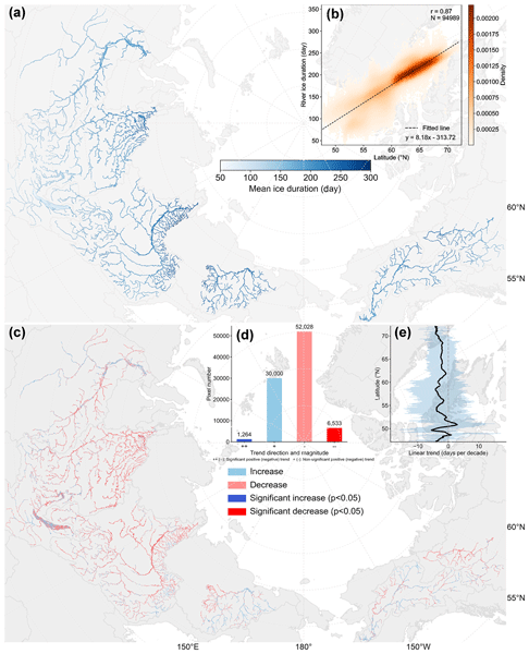
We developed a 24-year record revealing how river ice on the six largest Arctic rivers has changed under a warming climate. Using satellite images from the MODIS Terra and Aqua sensors, we monitored daily ice cover and seasonal freeze-up and breakup timing. On average, over 65 % of river segments show later freeze-up (~ 9 d), earlier breakup (~ 8 d), and shorter ice seasons (~ 14 d), revealing a clear signal of rapid warming across Arctic river systems.
Joonas Kousa, Teemu Hakala, Antero Kukko, and Harri Kaartinen
ISPRS Ann. Photogramm. Remote Sens. Spatial Inf. Sci., X-2-W2-2025, 101–108, https://doi.org/10.5194/isprs-annals-X-2-W2-2025-101-2025, https://doi.org/10.5194/isprs-annals-X-2-W2-2025-101-2025, 2025
Evgeny Lopatin, Kari Väätäinen, Harri Kaartinen, Heikki Hyyti, Lauri Sikanen, Yrjö Nuutinen, and Mauricio Acuna
ISPRS Ann. Photogramm. Remote Sens. Spatial Inf. Sci., X-2-W2-2025, 117–123, https://doi.org/10.5194/isprs-annals-X-2-W2-2025-117-2025, https://doi.org/10.5194/isprs-annals-X-2-W2-2025-117-2025, 2025
Matias Mäki-Leppilampi, Heikki Hyyti, and Harri Kaartinen
ISPRS Ann. Photogramm. Remote Sens. Spatial Inf. Sci., X-2-W2-2025, 125–132, https://doi.org/10.5194/isprs-annals-X-2-W2-2025-125-2025, https://doi.org/10.5194/isprs-annals-X-2-W2-2025-125-2025, 2025
Eugeniu Vezeteu, Heikki Hyyti, Ville Kyrki, and Juha Hyyppä
ISPRS Ann. Photogramm. Remote Sens. Spatial Inf. Sci., X-2-W2-2025, 199–206, https://doi.org/10.5194/isprs-annals-X-2-W2-2025-199-2025, https://doi.org/10.5194/isprs-annals-X-2-W2-2025-199-2025, 2025
Zuoya Liu, Harri Kaartinen, Teemu Hakala, Heikki Hyyti, Antero Kukko, Juha Hyyppa, and Ruizhi Chen
ISPRS Ann. Photogramm. Remote Sens. Spatial Inf. Sci., X-G-2025, 551–557, https://doi.org/10.5194/isprs-annals-X-G-2025-551-2025, https://doi.org/10.5194/isprs-annals-X-G-2025-551-2025, 2025
Tamás Faitli, Heikki Hyyti, Juha Hyyppä, Antero Kukko, and Harri Kaartinen
Int. Arch. Photogramm. Remote Sens. Spatial Inf. Sci., XLVIII-1-W4-2025, 37–42, https://doi.org/10.5194/isprs-archives-XLVIII-1-W4-2025-37-2025, https://doi.org/10.5194/isprs-archives-XLVIII-1-W4-2025-37-2025, 2025
Letícia F. Castanheiro, Antonio M. G. Tommaselli, Heikki Hyyti, and Antero Kukko
Int. Arch. Photogramm. Remote Sens. Spatial Inf. Sci., XLVIII-3-2024, 57–62, https://doi.org/10.5194/isprs-archives-XLVIII-3-2024-57-2024, https://doi.org/10.5194/isprs-archives-XLVIII-3-2024-57-2024, 2024
T. Faitli, T. Hakala, H. Kaartinen, J. Hyyppä, and A. Kukko
Int. Arch. Photogramm. Remote Sens. Spatial Inf. Sci., XLVIII-1-W1-2023, 145–150, https://doi.org/10.5194/isprs-archives-XLVIII-1-W1-2023-145-2023, https://doi.org/10.5194/isprs-archives-XLVIII-1-W1-2023-145-2023, 2023
V. V. Lehtola, H. Hyyti, and T. Malkamäki
Int. Arch. Photogramm. Remote Sens. Spatial Inf. Sci., XLVIII-2-W1-2022, 137–143, https://doi.org/10.5194/isprs-archives-XLVIII-2-W1-2022-137-2022, https://doi.org/10.5194/isprs-archives-XLVIII-2-W1-2022-137-2022, 2022
P. Rönnholm, S. Wittke, M. Ingman, P. Putkiranta, H. Kauhanen, H. Kaartinen, and M. T. Vaaja
Int. Arch. Photogramm. Remote Sens. Spatial Inf. Sci., XLIII-B2-2022, 633–639, https://doi.org/10.5194/isprs-archives-XLIII-B2-2022-633-2022, https://doi.org/10.5194/isprs-archives-XLIII-B2-2022-633-2022, 2022

The International Society for Photogrammetry and Remote Sensing is a non-governmental organization devoted to the development of international cooperation for the advancement of photogrammetry and remote sensing and their applications. The Society operates without any discrimination on grounds of race, religion, nationality, or political philosophy.
Useful Links
Useful External Links
Our Contact
c/o
Leibniz University Hannover
Institute of Photogrammetry and GeoInformation
Nienburger Str. 1
D-30167 Hannover
GERMANY
Email: isprs-sg@isprs.org