|
04 Aug 2026
Leveraging SDGSAT-1 data for exploring the interactions of nighttime lights and human settlement structure at high spatial resolution
Johannes H. Uhl, Martino Pesaresi, Michele Melchiorri, Panagiotis Politis, Linlin Lu, and Thomas Kemper
Related authors
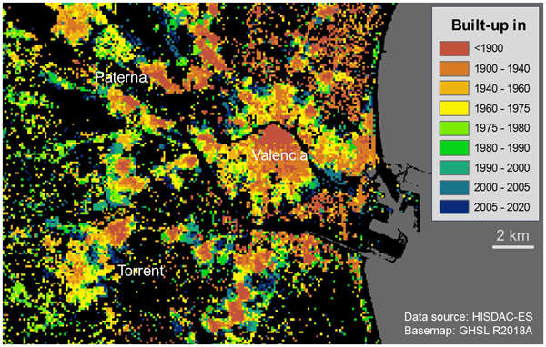
HISDAC-ES: historical settlement data compilation for Spain (1900–2020)
Johannes H. Uhl, Dominic Royé, Keith Burghardt, José A. Aldrey Vázquez, Manuel Borobio Sanchiz, and Stefan Leyk
Earth Syst. Sci. Data, 15, 4713–4747, https://doi.org/10.5194/essd-15-4713-2023,https://doi.org/10.5194/essd-15-4713-2023, 2023
Short summary
Towards the large-scale extraction of historical land cover information from historical maps
Johannes H. Uhl, Stefan Leyk, Weiwei Duan, Zekun Li, Basel Shbita, Yao-Yi Chiang, and Craig A. Knoblock
Abstr. Int. Cartogr. Assoc., 3, 297, https://doi.org/10.5194/ica-abs-3-297-2021,https://doi.org/10.5194/ica-abs-3-297-2021, 2021
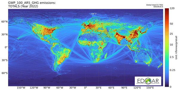
Insights into the spatial distribution of global, national, and subnational greenhouse gas emissions in the Emissions Database for Global Atmospheric Research (EDGAR v8.0)
Monica Crippa, Diego Guizzardi, Federico Pagani, Marcello Schiavina, Michele Melchiorri, Enrico Pisoni, Francesco Graziosi, Marilena Muntean, Joachim Maes, Lewis Dijkstra, Martin Van Damme, Lieven Clarisse, and Pierre Coheur
Earth Syst. Sci. Data, 16, 2811–2830, https://doi.org/10.5194/essd-16-2811-2024,https://doi.org/10.5194/essd-16-2811-2024, 2024
Short summary
HISDAC-ES: historical settlement data compilation for Spain (1900–2020)
Johannes H. Uhl, Dominic Royé, Keith Burghardt, José A. Aldrey Vázquez, Manuel Borobio Sanchiz, and Stefan Leyk
Earth Syst. Sci. Data, 15, 4713–4747, https://doi.org/10.5194/essd-15-4713-2023,https://doi.org/10.5194/essd-15-4713-2023, 2023
Short summary
TOWARDS A PAN-EU BUILDING FOOTPRINT MAP BASED ON THE HIERARCHICAL CONFLATION OF OPEN DATASETS: THE DIGITAL BUILDING STOCK MODEL - DBSM
P. Florio, C. Giovando, K. Goch, M. Pesaresi, P. Politis, and A. Martinez
Int. Arch. Photogramm. Remote Sens. Spatial Inf. Sci., XLVIII-4-W7-2023, 47–52, https://doi.org/10.5194/isprs-archives-XLVIII-4-W7-2023-47-2023,https://doi.org/10.5194/isprs-archives-XLVIII-4-W7-2023-47-2023, 2023
Towards the large-scale extraction of historical land cover information from historical maps
Johannes H. Uhl, Stefan Leyk, Weiwei Duan, Zekun Li, Basel Shbita, Yao-Yi Chiang, and Craig A. Knoblock
Abstr. Int. Cartogr. Assoc., 3, 297, https://doi.org/10.5194/ica-abs-3-297-2021,https://doi.org/10.5194/ica-abs-3-297-2021, 2021