- Article
(5801 KB) - Metadata XML
- September 24, 2026
- |
- Home
- |
- Sitemap
- |
- The ISPRS Foundation
- |
- 𝕏
The International Archives of the Photogrammetry, Remote Sensing and Spatial Information Sciences





Articles | Volume XLIX-B2-2026
https://doi.org/10.5194/isprs-archives-XLIX-B2-2026-569-2026
© Author(s) 2026. This work is distributed under
the Creative Commons Attribution 4.0 License.
the Creative Commons Attribution 4.0 License.
https://doi.org/10.5194/isprs-archives-XLIX-B2-2026-569-2026
© Author(s) 2026. This work is distributed under
the Creative Commons Attribution 4.0 License.
the Creative Commons Attribution 4.0 License.

23 Jul 2026
| 23 Jul 2026
Mobile Multi-camera System Performance for Photogrammetric Road Surface 3D Measurements – Assessment the Effect of Driving Speed
Matti T. Vaaja
Department of Built Environment, School of Engineering, Aalto University, FI-00076 Aalto, Finland
Markus Sarlin
Department of Built Environment, School of Engineering, Aalto University, FI-00076 Aalto, Finland
Eino Waldén
Department of Built Environment, School of Engineering, Aalto University, FI-00076 Aalto, Finland
Petri Rönnholm
Department of Built Environment, School of Engineering, Aalto University, FI-00076 Aalto, Finland
Hannu Hyyppä
Department of Built Environment, School of Engineering, Aalto University, FI-00076 Aalto, Finland
Juha Hyyppä
Department of Photogrammetry and Remote Sensing, Finnish Geospatial Institute FGI, Vuorimiehentie 5, FI-02150 Espoo, Finland
Mikko Vastaranta
School of Forest Sciences, University of Eastern Finland, FI-80101 Joensuu, Finland
Matti Kurkela
Department of Built Environment, School of Engineering, Aalto University, FI-00076 Aalto, Finland
Related authors
Susanna Hyyppä, Josef Taher, Matti Hyyppä, Leena Matikainen, Xiaowei Yu, Harri Kaartinen, Oskari Saarinen, Kirsi Karila, Ville Luoma, Marjut Turtiainen, Birgitta Partanen, Roope Näsi, Jyri Maanpää, Eetu Puttonen, Arttu Kivimäki, Mikko Vastaranta, Antero Kukko, Hannu Hyyppä, Matti Vaaja, Fabio Remondino, Narges Takhtkeshha, and Juha Hyyppä
Int. Arch. Photogramm. Remote Sens. Spatial Inf. Sci., XLIX-B1-2026, 443–448, https://doi.org/10.5194/isprs-archives-XLIX-B1-2026-443-2026, https://doi.org/10.5194/isprs-archives-XLIX-B1-2026-443-2026, 2026
Petri Rönnholm, Matti Kurkela, Matti Vaaja, and Hannu Hyyppä
Int. Arch. Photogramm. Remote Sens. Spatial Inf. Sci., XLIX-B2-2026, 63–70, https://doi.org/10.5194/isprs-archives-XLIX-B2-2026-63-2026, https://doi.org/10.5194/isprs-archives-XLIX-B2-2026-63-2026, 2026
Petri Rönnholm, Matti T. Vaaja, and Hannu Hyyppä
Int. Arch. Photogramm. Remote Sens. Spatial Inf. Sci., XLVIII-2-W11-2025, 255–262, https://doi.org/10.5194/isprs-archives-XLVIII-2-W11-2025-255-2025, https://doi.org/10.5194/isprs-archives-XLVIII-2-W11-2025-255-2025, 2025
Osama Bin Shafaat, Heikki Kauhanen, Arttu Julin, and Matti Vaaja
ISPRS Ann. Photogramm. Remote Sens. Spatial Inf. Sci., X-G-2025, 795–803, https://doi.org/10.5194/isprs-annals-X-G-2025-795-2025, https://doi.org/10.5194/isprs-annals-X-G-2025-795-2025, 2025
P. Rönnholm, S. Wittke, M. Ingman, P. Putkiranta, H. Kauhanen, H. Kaartinen, and M. T. Vaaja
Int. Arch. Photogramm. Remote Sens. Spatial Inf. Sci., XLIII-B2-2022, 633–639, https://doi.org/10.5194/isprs-archives-XLIII-B2-2022-633-2022, https://doi.org/10.5194/isprs-archives-XLIII-B2-2022-633-2022, 2022
Aimad El Issaoui, Veikka Taka, Harri Kaartinen, Antero Kukko, and Juha Hyyppä
Int. Arch. Photogramm. Remote Sens. Spatial Inf. Sci., XLIX-B2-2026, 169–174, https://doi.org/10.5194/isprs-archives-XLIX-B2-2026-169-2026, https://doi.org/10.5194/isprs-archives-XLIX-B2-2026-169-2026, 2026
Susanna Hyyppä, Josef Taher, Matti Hyyppä, Leena Matikainen, Xiaowei Yu, Harri Kaartinen, Oskari Saarinen, Kirsi Karila, Ville Luoma, Marjut Turtiainen, Birgitta Partanen, Roope Näsi, Jyri Maanpää, Eetu Puttonen, Arttu Kivimäki, Mikko Vastaranta, Antero Kukko, Hannu Hyyppä, Matti Vaaja, Fabio Remondino, Narges Takhtkeshha, and Juha Hyyppä
Int. Arch. Photogramm. Remote Sens. Spatial Inf. Sci., XLIX-B1-2026, 443–448, https://doi.org/10.5194/isprs-archives-XLIX-B1-2026-443-2026, https://doi.org/10.5194/isprs-archives-XLIX-B1-2026-443-2026, 2026
Hanna Sorokina, Mariana Campos, Taiga Korpelainen, Rami Echriti, Eetu Puttonen, Juha Hyyppä, and Yunsheng Wang
Int. Arch. Photogramm. Remote Sens. Spatial Inf. Sci., XLIX-B1-2026, 457–464, https://doi.org/10.5194/isprs-archives-XLIX-B1-2026-457-2026, https://doi.org/10.5194/isprs-archives-XLIX-B1-2026-457-2026, 2026
Petri Rönnholm, Matti Kurkela, Matti Vaaja, and Hannu Hyyppä
Int. Arch. Photogramm. Remote Sens. Spatial Inf. Sci., XLIX-B2-2026, 63–70, https://doi.org/10.5194/isprs-archives-XLIX-B2-2026-63-2026, https://doi.org/10.5194/isprs-archives-XLIX-B2-2026-63-2026, 2026
Zuoya Liu, Harri Kaartinen, Antero Kukko, Juha Hyyppa, and Ruizhi Chen
ISPRS Ann. Photogramm. Remote Sens. Spatial Inf. Sci., XI-1-2026, 297–302, https://doi.org/10.5194/isprs-annals-XI-1-2026-297-2026, https://doi.org/10.5194/isprs-annals-XI-1-2026-297-2026, 2026
Petri Rönnholm, Matti T. Vaaja, and Hannu Hyyppä
Int. Arch. Photogramm. Remote Sens. Spatial Inf. Sci., XLVIII-2-W11-2025, 255–262, https://doi.org/10.5194/isprs-archives-XLVIII-2-W11-2025-255-2025, https://doi.org/10.5194/isprs-archives-XLVIII-2-W11-2025-255-2025, 2025
Eugeniu Vezeteu, Heikki Hyyti, Ville Kyrki, and Juha Hyyppä
ISPRS Ann. Photogramm. Remote Sens. Spatial Inf. Sci., X-2-W2-2025, 199–206, https://doi.org/10.5194/isprs-annals-X-2-W2-2025-199-2025, https://doi.org/10.5194/isprs-annals-X-2-W2-2025-199-2025, 2025
Yunsheng Wang, Mariana Campos, Hanna Sorokina, Rami Echriti, Taiga Korpelainen, Juha Hyyppä, and Eetu Puttonen
Int. Arch. Photogramm. Remote Sens. Spatial Inf. Sci., XLVIII-G-2025, 1537–1541, https://doi.org/10.5194/isprs-archives-XLVIII-G-2025-1537-2025, https://doi.org/10.5194/isprs-archives-XLVIII-G-2025-1537-2025, 2025
Osama Bin Shafaat, Heikki Kauhanen, Arttu Julin, and Matti Vaaja
ISPRS Ann. Photogramm. Remote Sens. Spatial Inf. Sci., X-G-2025, 795–803, https://doi.org/10.5194/isprs-annals-X-G-2025-795-2025, https://doi.org/10.5194/isprs-annals-X-G-2025-795-2025, 2025
Zuoya Liu, Harri Kaartinen, Teemu Hakala, Heikki Hyyti, Antero Kukko, Juha Hyyppa, and Ruizhi Chen
ISPRS Ann. Photogramm. Remote Sens. Spatial Inf. Sci., X-G-2025, 551–557, https://doi.org/10.5194/isprs-annals-X-G-2025-551-2025, https://doi.org/10.5194/isprs-annals-X-G-2025-551-2025, 2025
Tamás Faitli, Heikki Hyyti, Juha Hyyppä, Antero Kukko, and Harri Kaartinen
Int. Arch. Photogramm. Remote Sens. Spatial Inf. Sci., XLVIII-1-W4-2025, 37–42, https://doi.org/10.5194/isprs-archives-XLVIII-1-W4-2025-37-2025, https://doi.org/10.5194/isprs-archives-XLVIII-1-W4-2025-37-2025, 2025
Matti Räsänen, Risto Vesala, Petri Rönnholm, Laura Arppe, Petra Manninen, Markus Jylhä, Jouko Rikkinen, Petri Pellikka, and Janne Rinne
Biogeosciences, 20, 4029–4042, https://doi.org/10.5194/bg-20-4029-2023, https://doi.org/10.5194/bg-20-4029-2023, 2023
Short summary
Short summary
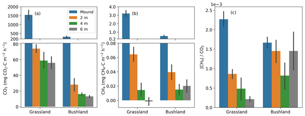
Fungus-growing termites recycle large parts of dead plant material in African savannas and are significant sources of greenhouse gases. We measured CO2 and CH4 fluxes from their mounds and surrounding soils in open and closed habitats. The fluxes scale with mound volume. The results show that emissions from mounds of fungus-growing termites are more stable than those from other termites. The soil fluxes around the mound are affected by the termite colonies at up to 2 m distance from the mound.
T. Faitli, T. Hakala, H. Kaartinen, J. Hyyppä, and A. Kukko
Int. Arch. Photogramm. Remote Sens. Spatial Inf. Sci., XLVIII-1-W1-2023, 145–150, https://doi.org/10.5194/isprs-archives-XLVIII-1-W1-2023-145-2023, https://doi.org/10.5194/isprs-archives-XLVIII-1-W1-2023-145-2023, 2023
L. Zhu, E. Hattula, J. Raninen, and J. Hyyppä
Int. Arch. Photogramm. Remote Sens. Spatial Inf. Sci., XLVIII-4-W1-2022, 561–568, https://doi.org/10.5194/isprs-archives-XLVIII-4-W1-2022-561-2022, https://doi.org/10.5194/isprs-archives-XLVIII-4-W1-2022-561-2022, 2022
P. Rönnholm, S. Wittke, M. Ingman, P. Putkiranta, H. Kauhanen, H. Kaartinen, and M. T. Vaaja
Int. Arch. Photogramm. Remote Sens. Spatial Inf. Sci., XLIII-B2-2022, 633–639, https://doi.org/10.5194/isprs-archives-XLIII-B2-2022-633-2022, https://doi.org/10.5194/isprs-archives-XLIII-B2-2022-633-2022, 2022
C. Jiang, Y. Chen, B. Xu, J. Jia, H. Sun, Z. He, T. Wang, and J. Hyyppä
Int. Arch. Photogramm. Remote Sens. Spatial Inf. Sci., XLVI-3-W1-2022, 61–66, https://doi.org/10.5194/isprs-archives-XLVI-3-W1-2022-61-2022, https://doi.org/10.5194/isprs-archives-XLVI-3-W1-2022-61-2022, 2022

The International Society for Photogrammetry and Remote Sensing is a non-governmental organization devoted to the development of international cooperation for the advancement of photogrammetry and remote sensing and their applications. The Society operates without any discrimination on grounds of race, religion, nationality, or political philosophy.
Useful Links
Useful External Links
Our Contact
c/o
Leibniz University Hannover
Institute of Photogrammetry and GeoInformation
Nienburger Str. 1
D-30167 Hannover
GERMANY
Email: isprs-sg@isprs.org