- Article
(957 KB) - Metadata XML
- October 20, 2026
- |
- Home
- |
- Sitemap
- |
- The ISPRS Foundation
- |
- 𝕏
The International Archives of the Photogrammetry, Remote Sensing and Spatial Information Sciences





Articles | Volume XLVIII-1/W2-2023
https://doi.org/10.5194/isprs-archives-XLVIII-1-W2-2023-523-2023
© Author(s) 2023. This work is distributed under
the Creative Commons Attribution 4.0 License.
the Creative Commons Attribution 4.0 License.
https://doi.org/10.5194/isprs-archives-XLVIII-1-W2-2023-523-2023
© Author(s) 2023. This work is distributed under
the Creative Commons Attribution 4.0 License.
the Creative Commons Attribution 4.0 License.

13 Dec 2023
| 13 Dec 2023
CONTENT PLANNING AND STRUCTURE DESIGN OF GLOBAL LAND COVER KNOWLEDGE ATLAS
X. Zhu
National Geomatics Center of China, No.28, Lianhuachi West Road, Haidian District, Beijing, 100830, China
Key Laboratory of Spatio-temporal Information and Intelligent Services, MNR, Beijing, 100830, China
L. Chen
National Geomatics Center of China, No.28, Lianhuachi West Road, Haidian District, Beijing, 100830, China
Y. Zhao
National Geomatics Center of China, No.28, Lianhuachi West Road, Haidian District, Beijing, 100830, China
W. Liu
National Geomatics Center of China, No.28, Lianhuachi West Road, Haidian District, Beijing, 100830, China
Key Laboratory of Spatio-temporal Information and Intelligent Services, MNR, Beijing, 100830, China
Y. Peng
National Geomatics Center of China, No.28, Lianhuachi West Road, Haidian District, Beijing, 100830, China
R. Li
National Geomatics Center of China, No.28, Lianhuachi West Road, Haidian District, Beijing, 100830, China
Key Laboratory of Spatio-temporal Information and Intelligent Services, MNR, Beijing, 100830, China
X. Zhai
National Geomatics Center of China, No.28, Lianhuachi West Road, Haidian District, Beijing, 100830, China
Key Laboratory of Spatio-temporal Information and Intelligent Services, MNR, Beijing, 100830, China
H. Xu
High-Tech Research & Development Center of the Ministry of Science & Technology, P.R.C., No.1, Sanlihe Road, Beijing, 100044, China
Related authors
Xiuli Zhu, Wei Zhang, Jie Yang, Ye Zhang, Ping Lu, Xiaoyu Liu, Yunlu Peng, Ran Li, Tingting Zhao, Xinpeng Wang, and Xinli Di
Int. Arch. Photogramm. Remote Sens. Spatial Inf. Sci., XLIX-B4-2026, 103–109, https://doi.org/10.5194/isprs-archives-XLIX-B4-2026-103-2026, https://doi.org/10.5194/isprs-archives-XLIX-B4-2026-103-2026, 2026
Ping Lu, Xiuli Zhu, Wanzeng Liu, Xinli Di, Ran Li, and Shangwei Lin
Int. Arch. Photogramm. Remote Sens. Spatial Inf. Sci., XLIX-B4-2026, 257–262, https://doi.org/10.5194/isprs-archives-XLIX-B4-2026-257-2026, https://doi.org/10.5194/isprs-archives-XLIX-B4-2026-257-2026, 2026
Y. Wan, X. Zhu, X. Zhai, Y. Zhang, T. Zhao, X. Di, and G. Du
Int. Arch. Photogramm. Remote Sens. Spatial Inf. Sci., XLVIII-1-W2-2023, 233–238, https://doi.org/10.5194/isprs-archives-XLVIII-1-W2-2023-233-2023, https://doi.org/10.5194/isprs-archives-XLVIII-1-W2-2023-233-2023, 2023
Y. Zhang, W. Liu, X. Zhu, Y. Peng, R. Li, T. Zhao, X. Wang, X. Zhai, X. Di, and H. Xu
Int. Arch. Photogramm. Remote Sens. Spatial Inf. Sci., XLVIII-1-W2-2023, 383–390, https://doi.org/10.5194/isprs-archives-XLVIII-1-W2-2023-383-2023, https://doi.org/10.5194/isprs-archives-XLVIII-1-W2-2023-383-2023, 2023
Y. Peng, W. Liu, R. Li, X. Zhu, Y. Zhang, T. Zhao, X. Zhai, X. Wang, X. Di, and L. Che
Int. Arch. Photogramm. Remote Sens. Spatial Inf. Sci., XLVIII-1-W2-2023, 983–988, https://doi.org/10.5194/isprs-archives-XLVIII-1-W2-2023-983-2023, https://doi.org/10.5194/isprs-archives-XLVIII-1-W2-2023-983-2023, 2023
T. T. Zhao, W. Z. Liu, X. L. Di, R. Li, X. P. Wang, X. Zhai, X. L. Zhu, Y. Zhang, and Y. L. Peng
Int. Arch. Photogramm. Remote Sens. Spatial Inf. Sci., XLVIII-3-W1-2022, 103–109, https://doi.org/10.5194/isprs-archives-XLVIII-3-W1-2022-103-2022, https://doi.org/10.5194/isprs-archives-XLVIII-3-W1-2022-103-2022, 2022
T. Zhao, X. Zhu, W. Liu, W. Ma, Y. Peng, Y. Zhang, X. Wang, Y. Wan, and X. Di
Int. Arch. Photogramm. Remote Sens. Spatial Inf. Sci., XLIII-B4-2022, 395–401, https://doi.org/10.5194/isprs-archives-XLIII-B4-2022-395-2022, https://doi.org/10.5194/isprs-archives-XLIII-B4-2022-395-2022, 2022
T. Zhao, Y. Zhao, W. Liu, X. Zhu, R. Li, X. Wang, X. Zhai, Y. Zhang, Y. Peng, and W. Ma
Int. Arch. Photogramm. Remote Sens. Spatial Inf. Sci., XLIII-B4-2022, 645–651, https://doi.org/10.5194/isprs-archives-XLIII-B4-2022-645-2022, https://doi.org/10.5194/isprs-archives-XLIII-B4-2022-645-2022, 2022
R. Li, W. Liu, Y. Peng, X. Zhu, T. Zhao, and L. Che
ISPRS Ann. Photogramm. Remote Sens. Spatial Inf. Sci., V-4-2022, 57–65, https://doi.org/10.5194/isprs-annals-V-4-2022-57-2022, https://doi.org/10.5194/isprs-annals-V-4-2022-57-2022, 2022
Y. Zhang, K. Qin, W. Liu, X. Zhu, Y. Peng, X. Wang, X. Zhai, T. Zhao, and R. Li
ISPRS Ann. Photogramm. Remote Sens. Spatial Inf. Sci., V-4-2022, 311–318, https://doi.org/10.5194/isprs-annals-V-4-2022-311-2022, https://doi.org/10.5194/isprs-annals-V-4-2022-311-2022, 2022
R. Li, W. Liu, W. Gong, X. Zhu, and X. Wang
ISPRS Ann. Photogramm. Remote Sens. Spatial Inf. Sci., V-3-2022, 591–596, https://doi.org/10.5194/isprs-annals-V-3-2022-591-2022, https://doi.org/10.5194/isprs-annals-V-3-2022-591-2022, 2022
Ping Lu, Xiuli Zhu, Wanzeng Liu, Xinli Di, Ran Li, and Shangwei Lin
Int. Arch. Photogramm. Remote Sens. Spatial Inf. Sci., XLIX-B4-2026, 257–262, https://doi.org/10.5194/isprs-archives-XLIX-B4-2026-257-2026, https://doi.org/10.5194/isprs-archives-XLIX-B4-2026-257-2026, 2026
Xiuli Zhu, Wei Zhang, Jie Yang, Ye Zhang, Ping Lu, Xiaoyu Liu, Yunlu Peng, Ran Li, Tingting Zhao, Xinpeng Wang, and Xinli Di
Int. Arch. Photogramm. Remote Sens. Spatial Inf. Sci., XLIX-B4-2026, 103–109, https://doi.org/10.5194/isprs-archives-XLIX-B4-2026-103-2026, https://doi.org/10.5194/isprs-archives-XLIX-B4-2026-103-2026, 2026
Ming Li, Fen Hu, Ju Bai, Lifei Feng, Hao Yu, and Yunlu Peng
ISPRS Ann. Photogramm. Remote Sens. Spatial Inf. Sci., XI-4-2026, 421–426, https://doi.org/10.5194/isprs-annals-XI-4-2026-421-2026, https://doi.org/10.5194/isprs-annals-XI-4-2026-421-2026, 2026
Zhihao Jiang, Ju Bai, Hao Yu, Yunlu Peng, Linlin Che, and He Zhang
ISPRS Ann. Photogramm. Remote Sens. Spatial Inf. Sci., XI-4-2026, 37–44, https://doi.org/10.5194/isprs-annals-XI-4-2026-37-2026, https://doi.org/10.5194/isprs-annals-XI-4-2026-37-2026, 2026
Jiaxin Ren, Wanzeng Liu, Feng Zhang, Jun Chen, Jiadong Zhang, Shunxi Yin, Shaoxuan Zhao, Guanfan Xi, Di Chen, and Kuanlin Dong
ISPRS Ann. Photogramm. Remote Sens. Spatial Inf. Sci., XI-3-2026, 253–260, https://doi.org/10.5194/isprs-annals-XI-3-2026-253-2026, https://doi.org/10.5194/isprs-annals-XI-3-2026-253-2026, 2026
Tingting Zhao, Yunlu Peng, Wanzeng Liu, Wei Ma, Xinli Di, Zhongliang Cai, Xinpeng Wang, and Linlin Che
Int. Arch. Photogramm. Remote Sens. Spatial Inf. Sci., XLVIII-4-2024, 585–590, https://doi.org/10.5194/isprs-archives-XLVIII-4-2024-585-2024, https://doi.org/10.5194/isprs-archives-XLVIII-4-2024-585-2024, 2024
Hongwei Zhang, Jiage Chen, Chenchen Wu, and Lijun Chen
Int. Arch. Photogramm. Remote Sens. Spatial Inf. Sci., XLVIII-1-2024, 837–842, https://doi.org/10.5194/isprs-archives-XLVIII-1-2024-837-2024, https://doi.org/10.5194/isprs-archives-XLVIII-1-2024-837-2024, 2024
Xiao Zhang, Tingting Zhao, Hong Xu, Wendi Liu, Jinqing Wang, Xidong Chen, and Liangyun Liu
Earth Syst. Sci. Data, 16, 1353–1381, https://doi.org/10.5194/essd-16-1353-2024, https://doi.org/10.5194/essd-16-1353-2024, 2024
Short summary
Short summary
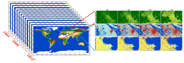
This work describes GLC_FCS30D, the first global 30 m land-cover dynamics monitoring dataset, which contains 35 land-cover subcategories and covers the period of 1985–2022 in 26 time steps (its maps are updated every 5 years before 2000 and annually after 2000).
T. Zhao, H. Li, X. Di, Z. Cai, Y. Wan, Y. Zhang, X. Wang, Y. Peng, L. Che, and H. Xu
Int. Arch. Photogramm. Remote Sens. Spatial Inf. Sci., XLVIII-1-W2-2023, 239–244, https://doi.org/10.5194/isprs-archives-XLVIII-1-W2-2023-239-2023, https://doi.org/10.5194/isprs-archives-XLVIII-1-W2-2023-239-2023, 2023
Y. Peng, W. Liu, R. Li, X. Zhu, Y. Zhang, T. Zhao, X. Zhai, X. Wang, X. Di, and L. Che
Int. Arch. Photogramm. Remote Sens. Spatial Inf. Sci., XLVIII-1-W2-2023, 983–988, https://doi.org/10.5194/isprs-archives-XLVIII-1-W2-2023-983-2023, https://doi.org/10.5194/isprs-archives-XLVIII-1-W2-2023-983-2023, 2023
Y. Zhang, W. Liu, X. Zhu, Y. Peng, R. Li, T. Zhao, X. Wang, X. Zhai, X. Di, and H. Xu
Int. Arch. Photogramm. Remote Sens. Spatial Inf. Sci., XLVIII-1-W2-2023, 383–390, https://doi.org/10.5194/isprs-archives-XLVIII-1-W2-2023-383-2023, https://doi.org/10.5194/isprs-archives-XLVIII-1-W2-2023-383-2023, 2023
Y. Wan, X. Zhu, X. Zhai, Y. Zhang, T. Zhao, X. Di, and G. Du
Int. Arch. Photogramm. Remote Sens. Spatial Inf. Sci., XLVIII-1-W2-2023, 233–238, https://doi.org/10.5194/isprs-archives-XLVIII-1-W2-2023-233-2023, https://doi.org/10.5194/isprs-archives-XLVIII-1-W2-2023-233-2023, 2023
B. Zhang, C. Yin, K. Liu, X. Zhai, Y. Sun, and M. Du
ISPRS Ann. Photogramm. Remote Sens. Spatial Inf. Sci., X-3-W2-2022, 79–85, https://doi.org/10.5194/isprs-annals-X-3-W2-2022-79-2022, https://doi.org/10.5194/isprs-annals-X-3-W2-2022-79-2022, 2022
T. T. Zhao, W. Z. Liu, X. L. Di, R. Li, X. P. Wang, X. Zhai, X. L. Zhu, Y. Zhang, and Y. L. Peng
Int. Arch. Photogramm. Remote Sens. Spatial Inf. Sci., XLVIII-3-W1-2022, 103–109, https://doi.org/10.5194/isprs-archives-XLVIII-3-W1-2022-103-2022, https://doi.org/10.5194/isprs-archives-XLVIII-3-W1-2022-103-2022, 2022
T. Zhao, Y. Zhao, W. Liu, X. Zhu, R. Li, X. Wang, X. Zhai, Y. Zhang, Y. Peng, and W. Ma
Int. Arch. Photogramm. Remote Sens. Spatial Inf. Sci., XLIII-B4-2022, 645–651, https://doi.org/10.5194/isprs-archives-XLIII-B4-2022-645-2022, https://doi.org/10.5194/isprs-archives-XLIII-B4-2022-645-2022, 2022
T. Zhao, X. Zhu, W. Liu, W. Ma, Y. Peng, Y. Zhang, X. Wang, Y. Wan, and X. Di
Int. Arch. Photogramm. Remote Sens. Spatial Inf. Sci., XLIII-B4-2022, 395–401, https://doi.org/10.5194/isprs-archives-XLIII-B4-2022-395-2022, https://doi.org/10.5194/isprs-archives-XLIII-B4-2022-395-2022, 2022
Y. Zhang, K. Qin, W. Liu, X. Zhu, Y. Peng, X. Wang, X. Zhai, T. Zhao, and R. Li
ISPRS Ann. Photogramm. Remote Sens. Spatial Inf. Sci., V-4-2022, 311–318, https://doi.org/10.5194/isprs-annals-V-4-2022-311-2022, https://doi.org/10.5194/isprs-annals-V-4-2022-311-2022, 2022
R. Li, W. Liu, Y. Peng, X. Zhu, T. Zhao, and L. Che
ISPRS Ann. Photogramm. Remote Sens. Spatial Inf. Sci., V-4-2022, 57–65, https://doi.org/10.5194/isprs-annals-V-4-2022-57-2022, https://doi.org/10.5194/isprs-annals-V-4-2022-57-2022, 2022
X. Wang, W. Liu, W. Sun, Y. Peng, Y. Zhang, X. Zhai, T. Zhao, and R. Li
ISPRS Ann. Photogramm. Remote Sens. Spatial Inf. Sci., V-3-2022, 303–310, https://doi.org/10.5194/isprs-annals-V-3-2022-303-2022, https://doi.org/10.5194/isprs-annals-V-3-2022-303-2022, 2022
R. Li, W. Liu, W. Gong, X. Zhu, and X. Wang
ISPRS Ann. Photogramm. Remote Sens. Spatial Inf. Sci., V-3-2022, 591–596, https://doi.org/10.5194/isprs-annals-V-3-2022-591-2022, https://doi.org/10.5194/isprs-annals-V-3-2022-591-2022, 2022

The International Society for Photogrammetry and Remote Sensing is a non-governmental organization devoted to the development of international cooperation for the advancement of photogrammetry and remote sensing and their applications. The Society operates without any discrimination on grounds of race, religion, nationality, or political philosophy.
Useful Links
Useful External Links
Our Contact
c/o
Leibniz University Hannover
Institute of Photogrammetry and GeoInformation
Nienburger Str. 1
D-30167 Hannover
GERMANY
Email: isprs-sg@isprs.org