- Article
(1537 KB) - Metadata XML
- September 24, 2026
- |
- Home
- |
- Sitemap
- |
- The ISPRS Foundation
- |
- 𝕏
The International Archives of the Photogrammetry, Remote Sensing and Spatial Information Sciences





Articles | Volume XLIX-B2-2026
https://doi.org/10.5194/isprs-archives-XLIX-B2-2026-261-2026
© Author(s) 2026. This work is distributed under
the Creative Commons Attribution 4.0 License.
the Creative Commons Attribution 4.0 License.
https://doi.org/10.5194/isprs-archives-XLIX-B2-2026-261-2026
© Author(s) 2026. This work is distributed under
the Creative Commons Attribution 4.0 License.
the Creative Commons Attribution 4.0 License.

23 Jul 2026
| 23 Jul 2026
Improving handheld Laser Scanning Point Cloud Quality in Forests via RTK-GNSS integrated SLAM
Carolin Rünger
Institute of Photogrammetry and Remote Sensing, Dresden University of Technology, 01069 Dresden, Germany
Stefan Binapfl
Geodetic Institute, Dresden University of Technology, 01069 Dresden, Germany
Sophia Böhme
Institute of Photogrammetry and Remote Sensing, Dresden University of Technology, 01069 Dresden, Germany
Ferdinand Maiwald
Geodetic Institute, Dresden University of Technology, 01069 Dresden, Germany
Anette Eltner
Institute of Photogrammetry and Remote Sensing, Dresden University of Technology, 01069 Dresden, Germany
Related authors
Stefan Binapfl, Carolin Rünger, Gunnar Lelle-Neumann, Anette Eltner, and Ferdinand Maiwald
Int. Arch. Photogramm. Remote Sens. Spatial Inf. Sci., XLIX-B1-2026, 129–136, https://doi.org/10.5194/isprs-archives-XLIX-B1-2026-129-2026, https://doi.org/10.5194/isprs-archives-XLIX-B1-2026-129-2026, 2026
Carolin Rünger, Mathias Gröbe, and Dirk Burghardt
Abstr. Int. Cartogr. Assoc., 5, 158, https://doi.org/10.5194/ica-abs-5-158-2022, https://doi.org/10.5194/ica-abs-5-158-2022, 2022
Bindusara Nagathihalli Lokesh, Laura Camila Duran Vergara, Hans-Gerd Maas, and Anette Eltner
Int. Arch. Photogramm. Remote Sens. Spatial Inf. Sci., XLIX-B3-2026, 205–212, https://doi.org/10.5194/isprs-archives-XLIX-B3-2026-205-2026, https://doi.org/10.5194/isprs-archives-XLIX-B3-2026-205-2026, 2026
Felix Rocco Matzke, Hans-Gerd Maas, and Anette Eltner
Int. Arch. Photogramm. Remote Sens. Spatial Inf. Sci., XLIX-B2-2026, 1183–1189, https://doi.org/10.5194/isprs-archives-XLIX-B2-2026-1183-2026, https://doi.org/10.5194/isprs-archives-XLIX-B2-2026-1183-2026, 2026
Lukas Quirin, Gunnar Lelle-Neumann, and Ferdinand Maiwald
Int. Arch. Photogramm. Remote Sens. Spatial Inf. Sci., XLIX-B2-2026, 979–987, https://doi.org/10.5194/isprs-archives-XLIX-B2-2026-979-2026, https://doi.org/10.5194/isprs-archives-XLIX-B2-2026-979-2026, 2026
Pedro Zamboni, Robert Krüger, László Bertalan, Xabier Blanch, Paul Hindorf, and Anette Eltner
Int. Arch. Photogramm. Remote Sens. Spatial Inf. Sci., XLIX-B2-2026, 321–326, https://doi.org/10.5194/isprs-archives-XLIX-B2-2026-321-2026, https://doi.org/10.5194/isprs-archives-XLIX-B2-2026-321-2026, 2026
Anne Bienert, Katja Richter, Sophia Böhme, and Hans-Gerd Maas
Int. Arch. Photogramm. Remote Sens. Spatial Inf. Sci., XLIX-B2-2026, 109–116, https://doi.org/10.5194/isprs-archives-XLIX-B2-2026-109-2026, https://doi.org/10.5194/isprs-archives-XLIX-B2-2026-109-2026, 2026
Stefan Binapfl, Carolin Rünger, Gunnar Lelle-Neumann, Anette Eltner, and Ferdinand Maiwald
Int. Arch. Photogramm. Remote Sens. Spatial Inf. Sci., XLIX-B1-2026, 129–136, https://doi.org/10.5194/isprs-archives-XLIX-B1-2026-129-2026, https://doi.org/10.5194/isprs-archives-XLIX-B1-2026-129-2026, 2026
Junquan Pan, Maria Chizhova, Mona Hess, Thomas Luhmann, and Ferdinand Maiwald
ISPRS Ann. Photogramm. Remote Sens. Spatial Inf. Sci., XI-1-2026, 217–226, https://doi.org/10.5194/isprs-annals-XI-1-2026-217-2026, https://doi.org/10.5194/isprs-annals-XI-1-2026-217-2026, 2026
Vaibhav Rajan, Sander Münster, Jonas Bruschke, and Ferdinand Maiwald
ISPRS Ann. Photogramm. Remote Sens. Spatial Inf. Sci., XI-2-2026, 127–135, https://doi.org/10.5194/isprs-annals-XI-2-2026-127-2026, https://doi.org/10.5194/isprs-annals-XI-2-2026-127-2026, 2026
Laura Camila Duran Vergara, Xabier Blanch Gorriz, Bindusara Nagathihalli Lokesh, and Anette Eltner
ISPRS Ann. Photogramm. Remote Sens. Spatial Inf. Sci., XI-2-2026, 615–622, https://doi.org/10.5194/isprs-annals-XI-2-2026-615-2026, https://doi.org/10.5194/isprs-annals-XI-2-2026-615-2026, 2026
Lea Epple, Oliver Grothum, Anne Bienert, and Anette Eltner
Earth Syst. Sci. Data, 18, 1275–1286, https://doi.org/10.5194/essd-18-1275-2026, https://doi.org/10.5194/essd-18-1275-2026, 2026
Short summary
Short summary
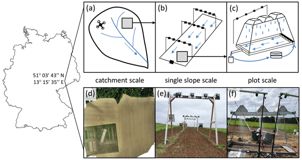
The present study offers a unique, nested, high-resolution dataset that captures soil surface changes every 20 seconds during rainfall events, as well as over seasonal variations, across a range of spatial scales – plot, slope, and catchment. It was collected over a period of 3.5 years and facilitated by a camera-based approach. This open-access resource assists scientists in evaluating and refining existing models, improving process understanding, and training artificial intelligence.
Xabier Blanch, Jens Grundmann, Ralf Hedel, and Anette Eltner
Hydrol. Earth Syst. Sci., 30, 797–824, https://doi.org/10.5194/hess-30-797-2026, https://doi.org/10.5194/hess-30-797-2026, 2026
Short summary
Short summary
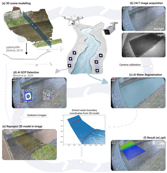
This study presents a low-cost, automated system for monitoring river water levels using cameras and AI. By combining AI-based image analysis with photogrammetry, it accurately measures water levels in real-time, even in challenging conditions. Tested over 2.5 years at four sites, it achieved high accuracy (errors of 1.0–2.3 cm) and processed over 219 000 images. Its resilience makes it ideal for flood detection and water management in remote areas.
Oliver Grothum, Lea Epple, Anne Bienert, Xabier Blanch, and Anette Eltner
SOIL, 11, 1007–1028, https://doi.org/10.5194/soil-11-1007-2025, https://doi.org/10.5194/soil-11-1007-2025, 2025
Short summary
Short summary
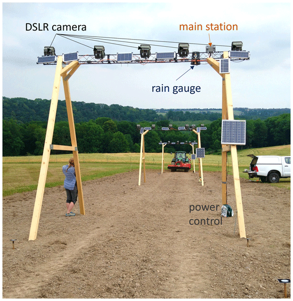
Soil erosion threatens landscapes worldwide, and understanding how surfaces change over time is key to addressing this issue. We developed a new camera-based system that automatically captures and analyzes daily surface changes on a hillside over several years. Triggered by rain and a clock, the system showed how weather and farming impact the land. Our method offers a powerful way to monitor surface changes and can help improve predictions and solutions for soil erosion.
Felix Rocco Matzke, Tushar Jayesh Barot, Shreeja Sridharan, Nikolaus Ammann, Christoph Kessler, Hans-Gerd Maas, Frank H. P. Fitzek, and Anette Eltner
Int. Arch. Photogramm. Remote Sens. Spatial Inf. Sci., XLVIII-2-W11-2025, 211–218, https://doi.org/10.5194/isprs-archives-XLVIII-2-W11-2025-211-2025, https://doi.org/10.5194/isprs-archives-XLVIII-2-W11-2025-211-2025, 2025
Vaibhav Rajan, Sander Münster, Jonas Bruschke, and Ferdinand Maiwald
Int. Arch. Photogramm. Remote Sens. Spatial Inf. Sci., XLVIII-M-9-2025, 1251–1256, https://doi.org/10.5194/isprs-archives-XLVIII-M-9-2025-1251-2025, https://doi.org/10.5194/isprs-archives-XLVIII-M-9-2025-1251-2025, 2025
Junquan Pan, Maria Chizhova, Frank Ebener, Thomas Luhmann, Christian Ledig, Ferdinand Maiwald, and Thomas Eißing
ISPRS Ann. Photogramm. Remote Sens. Spatial Inf. Sci., X-M-2-2025, 267–274, https://doi.org/10.5194/isprs-annals-X-M-2-2025-267-2025, https://doi.org/10.5194/isprs-annals-X-M-2-2025-267-2025, 2025
Hanne Hendrickx, Melanie Elias, Xabier Blanch, Reynald Delaloye, and Anette Eltner
Earth Surf. Dynam., 13, 705–721, https://doi.org/10.5194/esurf-13-705-2025, https://doi.org/10.5194/esurf-13-705-2025, 2025
Short summary
Short summary
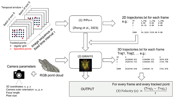
This study presents a novel AI-based method for tracking and analysing the movement of rock glaciers and landslides, key landforms in high mountain regions. By utilising time-lapse images, our approach generates detailed velocity data, uncovering movement patterns often missed by traditional methods. This cost-effective tool enhances geohazard monitoring, providing insights into environmental drivers, improving process understanding, and contributing to better safety in alpine areas.
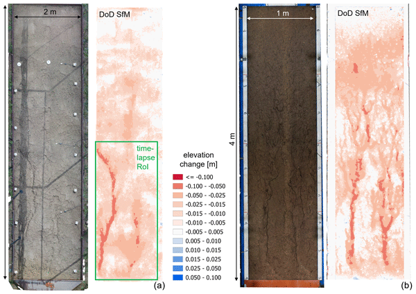
Anette Eltner, David Favis-Mortlock, Oliver Grothum, Martin Neumann, Tomáš Laburda, and Petr Kavka
SOIL, 11, 413–434, https://doi.org/10.5194/soil-11-413-2025, https://doi.org/10.5194/soil-11-413-2025, 2025
Short summary
Short summary
This study develops a new method to improve the calibration and evaluation of models that predict soil erosion by water. By using advanced imaging techniques, we can capture detailed changes in the soil surface over time. This helps improve models that forecast erosion, especially as climate change creates new and unpredictable conditions. Our findings highlight the need for more precise tools to better model erosion of our land and environment in the future.
Robert Krüger, Xabier Blanch, Jens Grundmann, Ghazi Al-Rawas, and Anette Eltner
Int. Arch. Photogramm. Remote Sens. Spatial Inf. Sci., XLVIII-2-W8-2024, 243–250, https://doi.org/10.5194/isprs-archives-XLVIII-2-W8-2024-243-2024, https://doi.org/10.5194/isprs-archives-XLVIII-2-W8-2024-243-2024, 2024
Pedro Alberto Pereira Zamboni, Hanne Hendrickx, Dennis Sprute, Holger Flatt, Muhtasimul Islam Rushdi, Florian Brodrecht, and Anette Eltner
Int. Arch. Photogramm. Remote Sens. Spatial Inf. Sci., XLVIII-2-W8-2024, 483–490, https://doi.org/10.5194/isprs-archives-XLVIII-2-W8-2024-483-2024, https://doi.org/10.5194/isprs-archives-XLVIII-2-W8-2024-483-2024, 2024
Clemens Schuwerack, Lukas Quirin, Gunnar Lelle-Neumann, and Ferdinand Maiwald
Int. Arch. Photogramm. Remote Sens. Spatial Inf. Sci., XLVIII-2-W7-2024, 153–160, https://doi.org/10.5194/isprs-archives-XLVIII-2-W7-2024-153-2024, https://doi.org/10.5194/isprs-archives-XLVIII-2-W7-2024-153-2024, 2024
Anne Bienert, Katja Richter, Sophia Boehme, and Hans-Gerd Maas
Int. Arch. Photogramm. Remote Sens. Spatial Inf. Sci., XLVIII-2-2024, 33–40, https://doi.org/10.5194/isprs-archives-XLVIII-2-2024-33-2024, https://doi.org/10.5194/isprs-archives-XLVIII-2-2024-33-2024, 2024
Melanie Elias, Steffen Isfort, Anette Eltner, and Hans-Gerd Maas
ISPRS Ann. Photogramm. Remote Sens. Spatial Inf. Sci., X-2-2024, 57–64, https://doi.org/10.5194/isprs-annals-X-2-2024-57-2024, https://doi.org/10.5194/isprs-annals-X-2-2024-57-2024, 2024
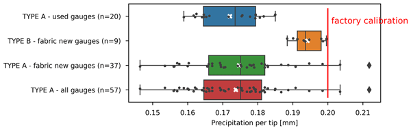
Robert Krüger, Pierre Karrasch, and Anette Eltner
Geosci. Instrum. Method. Data Syst., 13, 163–176, https://doi.org/10.5194/gi-13-163-2024, https://doi.org/10.5194/gi-13-163-2024, 2024
Short summary
Short summary
Low-cost sensors could fill gaps in existing observation networks. To ensure data quality, the quality of the factory calibration of a given sensor has to be evaluated if the sensor is used out of the box. Here, the factory calibration of a widely used low-cost rain gauge type has been tested both in the lab (66) and in the field (20). The results of the study suggest that the calibration of this particular type should at least be checked for every sensor before being used.
L. Morelli, F. Ioli, F. Maiwald, G. Mazzacca, F. Menna, and F. Remondino
Int. Arch. Photogramm. Remote Sens. Spatial Inf. Sci., XLVIII-2-W4-2024, 309–316, https://doi.org/10.5194/isprs-archives-XLVIII-2-W4-2024-309-2024, https://doi.org/10.5194/isprs-archives-XLVIII-2-W4-2024-309-2024, 2024
O. Grothum, A. Bienert, M. Bluemlein, and A. Eltner
Int. Arch. Photogramm. Remote Sens. Spatial Inf. Sci., XLVIII-1-W2-2023, 163–170, https://doi.org/10.5194/isprs-archives-XLVIII-1-W2-2023-163-2023, https://doi.org/10.5194/isprs-archives-XLVIII-1-W2-2023-163-2023, 2023
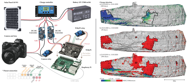
Xabier Blanch, Marta Guinau, Anette Eltner, and Antonio Abellan
Nat. Hazards Earth Syst. Sci., 23, 3285–3303, https://doi.org/10.5194/nhess-23-3285-2023, https://doi.org/10.5194/nhess-23-3285-2023, 2023
Short summary
Short summary
We present cost-effective photogrammetric systems for high-resolution rockfall monitoring. The paper outlines the components, assembly, and programming codes required. The systems utilize prime cameras to generate 3D models and offer comparable performance to lidar for change detection monitoring. Real-world applications highlight their potential in geohazard monitoring which enables accurate detection of pre-failure deformation and rockfalls with a high temporal resolution.
J. Bruschke, C. Kröber, F. Maiwald, R. Utescher, and A. Pattee
Int. Arch. Photogramm. Remote Sens. Spatial Inf. Sci., XLVIII-M-2-2023, 325–331, https://doi.org/10.5194/isprs-archives-XLVIII-M-2-2023-325-2023, https://doi.org/10.5194/isprs-archives-XLVIII-M-2-2023-325-2023, 2023
R. Blaskow and A. Eltner
Int. Arch. Photogramm. Remote Sens. Spatial Inf. Sci., XLVIII-1-W1-2023, 45–50, https://doi.org/10.5194/isprs-archives-XLVIII-1-W1-2023-45-2023, https://doi.org/10.5194/isprs-archives-XLVIII-1-W1-2023-45-2023, 2023
Carolin Rünger, Mathias Gröbe, and Dirk Burghardt
Abstr. Int. Cartogr. Assoc., 5, 158, https://doi.org/10.5194/ica-abs-5-158-2022, https://doi.org/10.5194/ica-abs-5-158-2022, 2022
F. Maiwald and H. Sardemann
Int. Arch. Photogramm. Remote Sens. Spatial Inf. Sci., XLIII-B2-2022, 823–829, https://doi.org/10.5194/isprs-archives-XLIII-B2-2022-823-2022, https://doi.org/10.5194/isprs-archives-XLIII-B2-2022-823-2022, 2022
S. Isfort, F. Maiwald, C. Mulsow, and H.-G. Maas
Int. Arch. Photogramm. Remote Sens. Spatial Inf. Sci., XLIII-B1-2022, 113–119, https://doi.org/10.5194/isprs-archives-XLIII-B1-2022-113-2022, https://doi.org/10.5194/isprs-archives-XLIII-B1-2022-113-2022, 2022
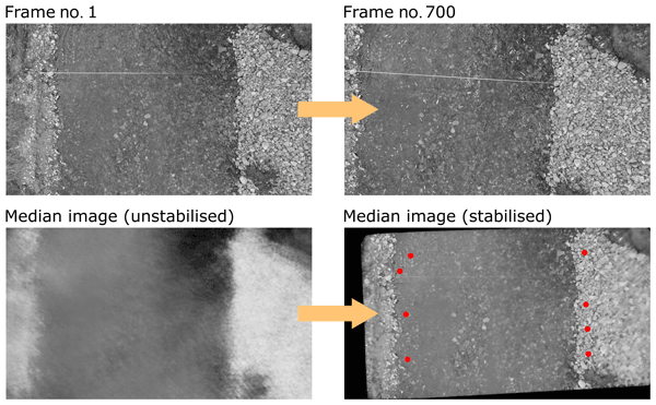
Robert Ljubičić, Dariia Strelnikova, Matthew T. Perks, Anette Eltner, Salvador Peña-Haro, Alonso Pizarro, Silvano Fortunato Dal Sasso, Ulf Scherling, Pietro Vuono, and Salvatore Manfreda
Hydrol. Earth Syst. Sci., 25, 5105–5132, https://doi.org/10.5194/hess-25-5105-2021, https://doi.org/10.5194/hess-25-5105-2021, 2021
Short summary
Short summary
The rise of new technologies such as drones (unmanned aerial systems – UASs) has allowed widespread use of image velocimetry techniques in place of more traditional, usually slower, methods during hydrometric campaigns. In order to minimize the velocity estimation errors, one must stabilise the acquired videos. In this research, we compare the performance of different UAS video stabilisation tools and provide guidelines for their use in videos with different flight and ground conditions.
S. Münster, F. Maiwald, J. Bruschke, C. Kröber, R. Dietz, H. Messemer, and F. Niebling
ISPRS Ann. Photogramm. Remote Sens. Spatial Inf. Sci., VIII-M-1-2021, 109–116, https://doi.org/10.5194/isprs-annals-VIII-M-1-2021-109-2021, https://doi.org/10.5194/isprs-annals-VIII-M-1-2021-109-2021, 2021
Lea Epple, Andreas Kaiser, Marcus Schindewolf, and Anette Eltner
SOIL Discuss., https://doi.org/10.5194/soil-2021-85, https://doi.org/10.5194/soil-2021-85, 2021
Revised manuscript not accepted
Short summary
Short summary
Intensified extreme weather events due to climate change can result in changes of soil erosion. These unclear developments make an improvement of soil erosion modelling all the more important. Assuming that soil erosion models cannot keep up with the current data, this work gives an overview of 44 models, their strengths and weaknesses and discusses their potential for further development with respect to new and improved soil and soil erosion assessment techniques.

The International Society for Photogrammetry and Remote Sensing is a non-governmental organization devoted to the development of international cooperation for the advancement of photogrammetry and remote sensing and their applications. The Society operates without any discrimination on grounds of race, religion, nationality, or political philosophy.
Useful Links
Useful External Links
Our Contact
c/o
Leibniz University Hannover
Institute of Photogrammetry and GeoInformation
Nienburger Str. 1
D-30167 Hannover
GERMANY
Email: isprs-sg@isprs.org